

Google Earth Time Lapse
Toronado3800 Zone 6 St Louis
12 years ago
Sort by:Oldest
Comments (14)
Related Stories
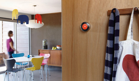
HOME TECHWhy Google Just Paid $3.2 Billion for a Company That Makes Thermostats
Smart home technology just got a new champion — and everyone is speculating about the reasons
Full Story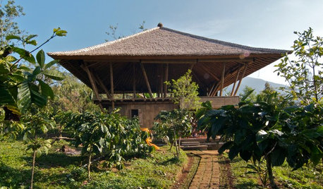
ARCHITECTURE15 Intriguing Homes Perched Above the Earth
Set on stilts, propped on pilotis or cantilevered into the air, these residences rise to the occasion
Full Story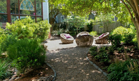
LANDSCAPE DESIGNEasy Ways to Manage Stormwater for Lower Bills and a Healthier Earth
Send cleaner runoff into local waterways and spend less on yard irrigation with these simple landscaping approaches
Full Story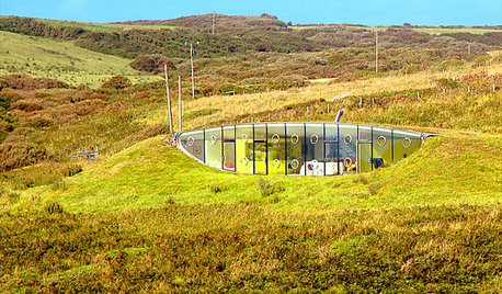
ARCHITECTURE6 Amazing Homes Dug Into the Earth
Designed to disappear or with portions peeking out, these houses bring a new meaning to 'communing with nature'
Full Story
PRODUCT PICKSGuest Picks: Earth-Friendlier Finds for the Home
Reduce paper and plastic use the simple, stylish way with ecoconscious kitchen, laundry and bathroom items
Full Story
ARCHITECTURETime-Tested, Low-Tech Ways to Cool a Home
People have been beating the heat around the world for centuries without plugging anything in. Could these ideas work for your home today?
Full Story
FALL GARDENINGWhy Fall Is the Best Time for Planting
Spring is overrated for planting. Starting plants in autumn has advantages for both garden and gardener
Full Story
HOME TECHThe Inevitable Future of Drones Around Your Home
As Google joins the push for airborne deliveries, it seems only a matter of time before neighborhoods are buzzing with drones. Is that OK?
Full Story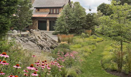
GARDENING GUIDES13 Risks to Take for True Garden Rewards
Go ahead, be a rebel. Breaking rules in the garden can lead to more happiness, creativity and connection with the earth
Full Story
MOST POPULAREasy Green: 23 Ways to Reduce Waste at Home
Pick from this plethora of earth-friendly ideas to send less to the landfill and keep more money in your pocket
Full StoryMore Discussions
sluice
krnuttle
Related Professionals
Tempe Landscape Architects & Landscape Designers · Lake Oswego Landscape Architects & Landscape Designers · Parole Landscape Architects & Landscape Designers · Bethel Park Landscape Contractors · Fair Lawn Landscape Contractors · New Brighton Landscape Contractors · Panama City Beach Landscape Contractors · South Portland Landscape Contractors · Tuscaloosa Landscape Contractors · Rosemont Siding & Exteriors · Elizabeth Siding & Exteriors · Weymouth Siding & Exteriors · Fishers Decks, Patios & Outdoor Enclosures · Highland Decks, Patios & Outdoor Enclosures · Jericho Stone, Pavers & Concretej0nd03
poaky1
whaas_5a
Toronado3800 Zone 6 St LouisOriginal Author
whaas_5a
pineresin
whaas_5a
Katsura Gardens
Toronado3800 Zone 6 St LouisOriginal Author
franktank232
pineresin
whaas_5a