


USDA's Web Soil Survey
brandon7 TN_zone7
10 years ago
Featured Answer
Sort by:Oldest
Comments (22)

wisconsitom
10 years agolast modified: 9 years agoarktrees
10 years agolast modified: 9 years agoRelated Professionals
Jennings Landscape Architects & Landscape Designers · Willowick Landscape Architects & Landscape Designers · Waterbury Landscape Contractors · Dallas Landscape Contractors · Wayland Landscape Contractors · Cypress Siding & Exteriors · Paramus Siding & Exteriors · Baker Decks, Patios & Outdoor Enclosures · Brooklyn Park Decks, Patios & Outdoor Enclosures · Cedar Falls Decks, Patios & Outdoor Enclosures · Fort Lee Decks, Patios & Outdoor Enclosures · New Lenox Decks, Patios & Outdoor Enclosures · Roseville Decks, Patios & Outdoor Enclosures · Wentzville Decks, Patios & Outdoor Enclosures · Finneytown Stone, Pavers & Concretearktrees
10 years agolast modified: 9 years ago
bengz6westmd
10 years agolast modified: 9 years agohairmetal4ever
10 years agolast modified: 9 years ago
whaas_5a
10 years agolast modified: 9 years agohairmetal4ever
10 years agolast modified: 9 years agohairmetal4ever
10 years agolast modified: 9 years agoginkgonut
10 years agolast modified: 9 years agotreebarb Z5 Denver
10 years agolast modified: 9 years agoarktrees
10 years agolast modified: 9 years ago
gardener365
10 years agolast modified: 9 years agoterrene
10 years agolast modified: 9 years agowhaas_5a
10 years agolast modified: 9 years agobrandon7 TN_zone7
10 years agolast modified: 9 years agowhaas_5a
10 years agolast modified: 9 years agobrandon7 TN_zone7
10 years agolast modified: 9 years agoarktrees
10 years agolast modified: 9 years agowhaas_5a
10 years agolast modified: 9 years agotcheever_soils
8 years agoedlincoln
8 years ago
Related Stories
FARM YOUR YARDHow to Get Good Soil for Your Edible Garden
The nutrients in your soil feed the plants that feed you. Here are tips on getting it right — just in time for planting season
Full Story
GARDENING GUIDESGrow a Beautiful Garden in Alkaline Soil
Got alkaline soil? Learn how to manage it and the many beautiful plants that will thrive in this ‘sweet’ soil
Full Story
GARDENING GUIDESGet the Dirt on Your Garden’s Soil
Understand how your soil supports your plants so you can ensure your garden’s success
Full Story
ARCHITECTUREWant to Live by the Water? What You Need to Know
Waterside homes can have amazing charm, but you'll have to weather design restrictions, codes and surveys
Full Story
FALL GARDENING6 Splendid Blue-Flowering Bulbs
How do you blue? With colors from sky to cobalt, these bulbs will greet you merrily in a spring garden
Full Story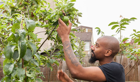
GARDENING GUIDESLush, Foodie Abundance in a Small Urban Garden
This modest backyard garden provides its owner with fruit and vegetables all year round, thanks to an innovative low-maintenance approach
Full Story
LANDSCAPE DESIGNCelebrate a Sunny Climate With the Right Leafy Palm for Your Site
So you get freezes or floods. So your garden is small. These palms send excuses riding off into the tropical sunset
Full Story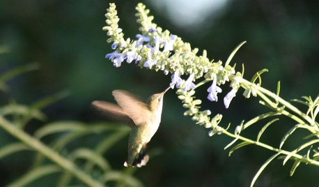
GARDENING GUIDESHow to Find the Right Native Plants for Your Yard
Find plant maps, sale sites and guides that make going native in the garden easier than ever
Full Story
LANDSCAPE DESIGNHow to Design Your Landscape to Sink Water Into the Ground
Learn to infiltrate stormwater, even on challenging sites
Full Story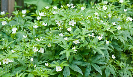
GARDENING GUIDESGreat Design Plant: Anemone Canadensis Adds Pizzazz to Water’s Edges
Plant Canadian anemone along pond, lake or stream edges for a splash of white flowers in late spring
Full Story

whaas_5a